
Software & services — EU
UgCS 6.3 automates terrain following for complex LiDAR surveys
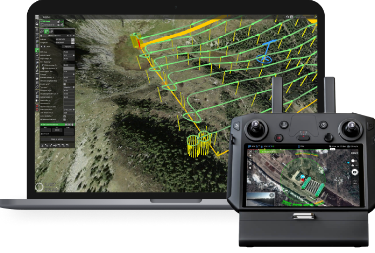
Software-driven terrain following

UgCS 6.3 adds automatic terrain-following control for LiDAR surveys. The feature applies to missions where the drone carries a LiDAR sensor, that is, a laser that measures distances and produces a point cloud, useful beneath vegetation. The software supports maintaining the trajectory relative to the terrain, which removes some of the manual readjustments between two passes.
SPH Engineering, publisher of UgCS, presents this version as a way to harmonise three parameters on the same site: sensor settings, calibration and trajectory. On a multi-sensor survey, these three elements must remain consistent from one flight to the next; otherwise point clouds do not stitch together well and rework accumulates.
The publisher is organising a free webinar on 10 November. The announced programme covers planning LiDAR surveys of 100 hectares and more in UgCS 6.3, configuration of DJI L1, L2 and L3 payloads, IMU calibration and the latest terrain-following tools.
Terrain following is not an isolated component in the software. UgCS documentation lists LiDAR area, LiDAR corridor and manual IMU calibration tools alongside conventional photogrammetric flight modes, with separate guides for versions 4.22, 5.17, 6.0, 6.1.0 and 6.2.1. Version 6.3 automates control of this terrain following for complex cases.
Platforms, payloads and integration with the existing workflow
SPH Engineering states that the feature has been proven on DJI M400, M350, M300, Inspired Flight and other professional platforms. The payloads cited in the webinar are DJI L1, L2 and L3.
Connection is made through the already documented gateways: UgCS for DJI, DJI Pilot 2, UgCS Companion, HereLink, and the direct connection intended for UgCS PRO and EXPERT licences. The documentation also describes setting up a DJI M300 RTK with a D-RTK 2 base in UgCS for DJI, as well as enabling triggering of non-DJI cameras on A3, N3 and M600. A site already operating on these workflows has no format discontinuity to anticipate on the flight-plan side.
The licence level required for automatic terrain-following control is not specified.
For large areas, UgCS has a Large Projects module that divides an area into sub-areas and allows surveys of 2,000 hectares and more to be programmed in a single programme. Terrain following fits into this framework: it acts on each portion of the trajectory, with the division remaining the operator's responsibility.
The limitations that the version does not remove
A 500-hectare mining site or a 200 km corridor does not fit into one flight. Division into missions remains mandatory, with the rework that this implies between flights, even if the software absorbs part of it.
IMU calibration remains a manual step, tooled in UgCS but not removed. The 10 November webinar devotes a segment to it, which indicates that it remains a checkpoint for the operator before sending the mission.
The actual gain in precision and time on sites of several hundred hectares remains to be documented. SPH Engineering announces automatic control and harmonisation of parameters; no published measurement quantifies the reduction in rework or the difference in point density between two passes.
Mines, corridors and large areas
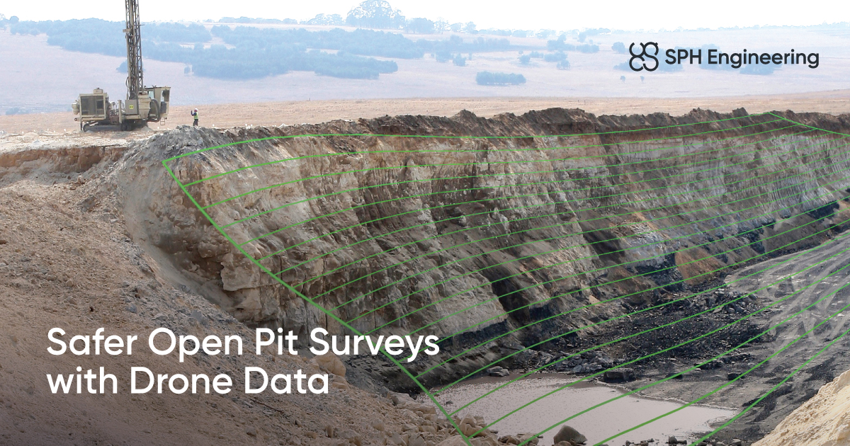
The operations targeted are those combining a large surface area and pronounced relief. SPH Engineering positions UgCS for open-pit mine mapping, slope monitoring, volume measurement and stockpile monitoring, with applications tailored for industrial inspection, 3D mapping, detection of buried networks and monitoring of tailings storage facilities. These missions require a constant height above ground to maintain a homogeneous point density.
Pipeline, power-line or linear-infrastructure corridors fall under the same need, with a length constraint that exceeds the capacity of one flight. The publisher claims 5,000 drone teams using its products worldwide.
The question of preparation time remains. A coherent multi-sensor flight plan assumes that sensor settings, calibration and trajectory are handled together. Version 6.3 automates the third component and leaves the first two to the operator, with documented tooling and a free training session scheduled for 10 November.
← Back to home · Search · Suggest a topic · Lire en français / Read in French